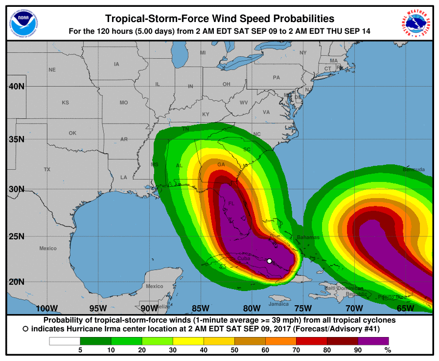
Outer bands bringing strong wind and rain from Hurricane Irma began to pound the southernmost reaches of Florida this morning (Saturday 9/9/17). The storm is now a Category 4 with sustained winds of 130 mph which will bring storm surge, rain, flooding and devastating gale force winds. Hurricane conditions are expected to begin Saturday night int he Florida Keys and across the southern and central Florida coasts.
"The storm is here. This is a deadly storm, and our state has never seen anything like it," said Florida Governor Rick Scott.
The eye of Hurricane Irma is expected to hit the Florida Keys Sunday morning before moving up the west coast of Florida including Naples, Fort Myers and Tampa Bay. Officials warn that just because the storm's path has shifted west does not mean that the east coast is safe and is at risk of severe danger of storm surge, flooding and devastating winds which threaten many of the construction cranes in Miami's burgeoning metropolitan areas.
We reported yesterday (Friday 9/8/17) that the largest mandatory evacuation order in the history of the United States are in effect for all of Miami Beach, Brickell and Downtown, amongst others counties. Over 650,000 people in the Miami area are effected by the storm and evacuation orders. Other evacuation orders include Broward County east of US 1, Palm Beach County, parts of Brevard County, coastal Jacksonville and Duval County, and Monroe County, which was among the first as it features the Florida Keys.


